Wednesday, October 1, 2014

Canyonlands National Park - Island in the Sky


We begin our Canyonlands adventure with our stay in Moab, Utah. Canyonlands National Park, described as 527 square miles of wild America, is divided into three regions: Island in the Sky, The Maze, and The Needles. Today we are exploring Island in the Sky.


Candlestick Tower
Mesa Arch


Green River Overlook


Upheaval Dome thought to be caused by a meteorite


A closer look of the dome

Shafer Trail Road


Morgan club visiting the park

Tuesday, September 30, 2014

Capitol Reef National Park


Beautiful aspen trees turning their fall colors as we drove over Boulder Mountain at a summit of 9600 feet, traveling Scenic Byway 12 from Kodachrome to Torrey - destination Capitol Reef.


The Fluted Wall

Goosenecks

The Castle
Navajo Knob


Hickman Bridge
Hiking to Hickman Bridge

Capitol Dome


Thinks he's going to get an apple pie
Apple orchards discovered along the road


Typical lunch for my driver


Saturday, September 27, 2014

Hole-in-the-Rock Road - Escalante, Utah

Hole-in-the-Rock Road was one of the few dirt roads we planned on exploring that was not closed due to recent rains in this area. The underlying clay conditions, common to this area, can take quite long to dry out resulting in hazardous driving conditions, and reason for us to cut short our stay at Kodachrome.

Beginning 5 miles east of Escalante off Scenic Byway 12, the 57 mile gravel and dirt Hole-in-the-Rock Rd closely follows the route taken by Mormon pioneers in 1879-80 in an attempt to establish a shortcut across the Colorado River.


Metate Arch


 After traveling twenty minutes along this rough road, in what appears to be the middle of nowhere, is found Devil's Garden, as the sign says "an outstanding natural area".
The 4 Hoodoos

Jim standing near hoodoos

Joyce with more hoodoos!


Mano Arch or Jim's "Tortoise Arch"


Cool place to take in the views


Bryce Canyon National Park

Bryce Canyon National Park was our first visit off Scenic Byway 12 a 124 mile stretch that is home to two national parks, three state parks, a national recreation area, a national monument and a national forest.


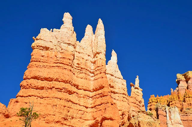
Bryce Canyon is actually not a canyon, but a series of amphitheaters etched into the pink Claron limestone of the Paunsaugunt Plateau. Many multi-colored  hoodoos, pinnacles, buttresses and columns are visible from the 37 mile round-trip scenic drive through the park.


Photos taken along our hike on the Queen's Garden Trail.


View from Fairyland Point


A beautiful day for a bicycle ride on one of Red Canyon's bicycle trails, also located along
Scenic Byway 12.


Kodachrome Basin State Park

Kodachrome Basin State Park was a beautiful base camp for our visit to Bryce Canyon National Park, Red Canyon State Park, and the Grand Staircase-Escalante National Monument. The colors and beauty found here prompted a National Geographic Society expedition to name the area "Kodachrome" after the popular color film in 1948.

Campsite view


Views along the Angel Palace Trail in the park.


Sedimentary pipes